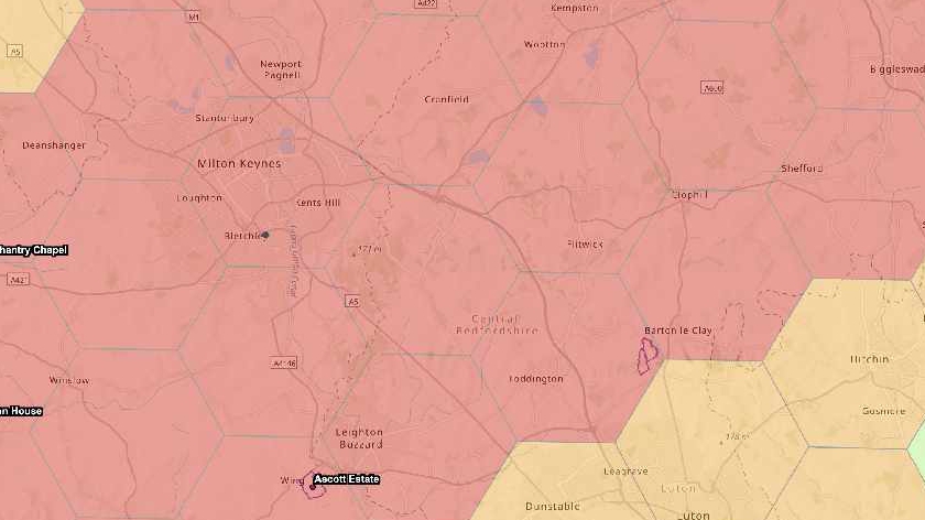
A "game changer" climate map has been drawn up by the National Trust, showing the threat extreme heat, humidity and landslides will have on the UK.
The map is based on a "worst case scenario" of a failure to drive down carbon emissions over the coming decades, but is intended to be a flagging tool to highlight potential hazards surrounding heritage or countryside site.
It has been drawn up to help the charity intervene to protect its sites, outlining the effect posted by climate impacts including rising heat and humidy, landslides, high winds, and floods, and how they could change by 2060.
According to the map, the National Trust place Milton Keynes under a possible level 5 high risk when it comes to the affect of overheating, humidty and soil heave by 2026.
National Trust director for land and nature Harry Bowel said: "This map is a game changer in how we face the threat climate change poses to the places we care for.
"While the data draws on a worst-case scenario, the map paints a stark picture of what we have to prepare for. But by acting now, and working with nature, we can adapt to many of these risks."
The map plots the impacts of extreme heat and humidity, landslides, coastal erosion, shrinking and shifting ground due to wet and dry conditions known as "soil heave", and high winds, in 2020 and 2060.
It uses data from a number of sources and plots them in 5km hexagonal grids across England, Wales and Northern Ireland.